
Looking Up Your Northglenn Neighbors
A block lookup combines physical adjacency with record-specific checks. The coverage table shows what each local source can add and where the limits begin. A Northglenn neighbors lookup is not a citywide neighborhood roster, and no complete association directory was located in the research sweep.
| Source | What it shows about a block | Access | Limit |
|---|---|---|---|
| Adams GIS | Adjacent parcels, IDs, splits, merges, map context | Interactive map | Dynamic and information-only, not a survey |
| Northglenn ArcGIS | Wards, Neighborhood Services Wards, zoning, street/block layer | REST service and map views | No resident fields exposed |
| USPS | Street, unit, city, state, ZIP normalization | By Address, City and State, ZIP | Does not confirm occupants |
| Assessor | Parcel owner and tax/address context | Adams or Weld search | Owner is not occupant |
| Recorder | Ownership transfers on each parcel | Grantor and grantee index | Adjacent parcels require separate searches |
| Voter list | Public-file address and participation fields | SOS or Adams request | Protected addresses and fields withheld |
| City webdocs | Ward, meeting, project, and area notices | Northglenn records umbrella | Meeting participation is not residence proof |
| NURA project material | One defined project area | City-hosted RFP | Not a citywide neighborhood inventory |
The strongest result is usually a parcel relationship plus a named, dated record. A map alone shows where a parcel sits, not who uses it.
Mapping a Northglenn Block: Parcels and Owners
Start with one known address and work outward one parcel at a time. Use the physical parcel as the anchor. An adjacent polygon can identify the next parcel, but the owner, deed, voter, or directory result for that parcel must be researched separately.
- Normalize the target street, unit, postal city, state, and ZIP with USPS By Address.
- Use Adams Property Search first for the developed city and Weld Basic Property Search if the parcel points to Section 36.
- Save the target account, parcel, situs, owner label, county, and date.
- Open Adams GIS and identify the polygons that share a boundary with the target.
- Carry each adjacent account or address to the assessor, recorder, permit, or public-file source that fits the question.
- Use Northglenn's map layers for ward, zoning, neighborhood-service, and street/block context.
The result is a block map with source labels, not a published neighbor roster. A Northglenn neighbors search should use the phrase “adjacent parcel” until a specific record supports a narrower description.
- Adjacent parcel
- A parcel that shares a boundary with the target polygon in the map or parcel layer.
- Block layer
- A map layer describing street or block geography, not a list of people.
- Ward
- A service or election geography that can overlap a block without defining household identity.
- Owner of record
- The owner field attached to a parcel record, distinct from an occupant or neighbor.
Adjacent Parcels in Northglenn GIS
Adams GIS is the main geography bridge for the developed city. Select a target parcel, identify its account or parcel clue, and compare shared boundaries with surrounding polygons. Parcel splits, merges, subdivisions, and surveys can change the shape of a block over time. A Northglenn neighbors lookup can use a neighboring polygon as a research target, not as a person result.
The live map viewer was dynamic and returned 403 during the source inspection. The documented workflow is therefore a field guide, not a captured Northglenn parcel card. Save the map date, layer, account or parcel key, and disclaimer. A legal boundary question should move to a recorded plat, survey, or recorder instrument.
Northglenn's boundary exception matters here. If an adjacent parcel sits in the Weld Section 36 area, route the owner and deed checks to Weld rather than assuming every block around a city address belongs to Adams.
Note: GIS makes adjacency visible, but it cannot establish who occupies an adjacent parcel.
Northglenn's Official Block Layer
The Northglenn ArcGIS MapServer exposes a street/name/block layer identified in the research as NGarcsde.DBO.stnam_eop_blk. The same service includes Northglenn Wards, Neighborhood Services Wards, and zoning. Those names give a neighbor lookup a concrete official geography source without pretending the endpoint is a resident database.
Read layer metadata, service date, field names, and geometry. Do not infer a household from a block label or ward polygon. Map services can change, and the inspection did not expose person fields. The layer is best used to confirm the block or service area before the parcel-by-parcel record work.
Screenshot source: the Northglenn official map service provides the ward, zoning, neighborhood-service, and block-layer context.
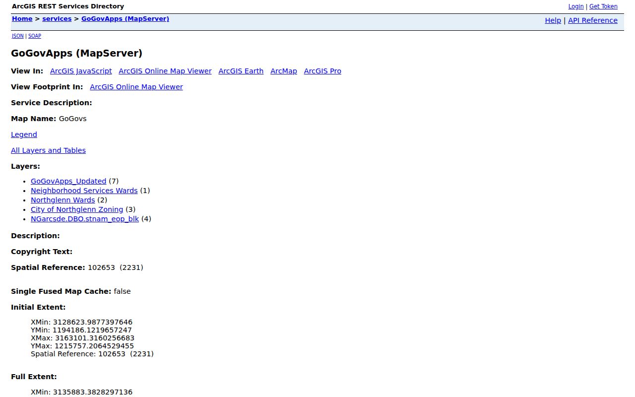
The image supports a geography workflow. It does not identify neighbors or provide a citywide roster.
Northglenn Wards and Neighborhood Services
Ward and Neighborhood Services Wards are service geographies. They can help explain which map layer, meeting notice, or city contact relates to a block. They do not define a formal neighborhood name unless a current city source gives that boundary. The research did not locate an official citywide neighborhood-name directory.
Keep ward, neighborhood-service, zoning, and block labels separate. A Northglenn neighbors lookup may use a public meeting notice to understand an area or project, but attendance or a name in the packet does not establish a home address. The same caution applies to a business, license, permit, or council record tied to a nearby place.
Adams Elections and Colorado SOS may provide public-file address and participation categories, but protected voter addresses, confidential identifiers, and under-18 information are withheld. A request for a block list is not automatically available, and the city or county is not required to merge separate records into a new neighbor directory. Ask for the narrow record, date, district, or map layer instead.
Northglenn Map Service
Wards, Neighborhood Services Wards, zoning, block layer
Public Research Anchors
Danahy Park, Recreation Center, Huron service, bookmobile
These public anchors help a researcher understand local geography without turning service use into an individual identity claim.
Northglenn's NURA I-25 and UPPR Area
A Northglenn Urban Renewal Authority RFP describes a project area bounded north by E 120th Avenue, south by E 104th Avenue, east by the UPPR Railroad, and west by I-25. The material describes built-out residential and commercial uses around major thoroughfares. It is a specific project area, not a citywide neighborhood register.
This boundary can add context when a block question concerns a redevelopment or planning file. It cannot supply a list of adjacent households. Use the city-hosted document for the project boundary, then check the parcel, meeting record, permit, or CORA route for the precise record sought.
The area label also shows why a “neighborhood” can mean different things in different sources: planning area, ward, service area, project area, or informal local name. Preserve the source's own term.
Northglenn Public Places Around a Block
Public places add local context without exposing who uses them. Anythink Huron in Thornton serves Northglenn, Thornton, and Federal Heights. The 2026 bookmobile schedule lists Northglenn stops at Danahy Park and the Northglenn Recreation Center. Those anchors can help a researcher understand service geography, library referral routes, and public meeting locations for a Northglenn neighbors question.
Northglenn's city records umbrella gathers agendas, packets, audio, and official records. Search terms can reveal an area, organization, applicant, or council participant, but the result remains a city record. It does not certify that the named person lives beside the target parcel.
Screenshot source: the Northglenn public meeting and records umbrella shows the city-level context used for local block research.
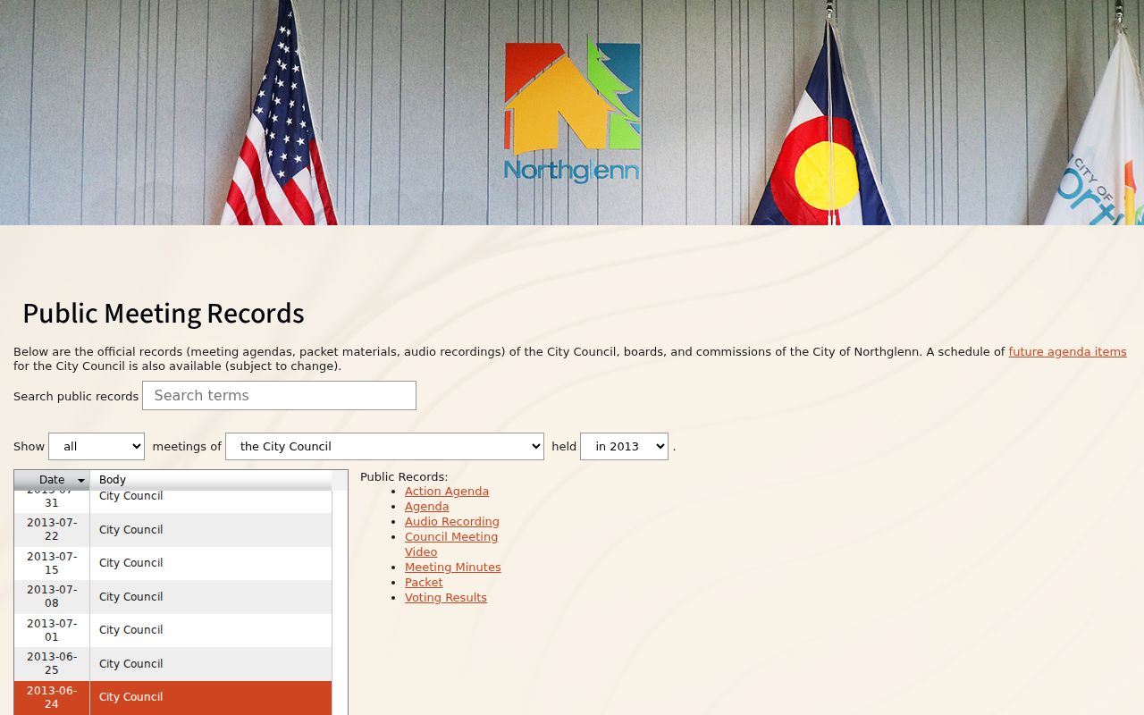
The capture is an official records entry point, not a neighborhood roster.
No complete official association directory was located. A request for a specific city-held meeting, service, or project record is more reliable than an unsourced list of neighborhood names.
Privacy Limits on a Northglenn Neighbor Lookup
Colorado voter files can withhold protected addresses and confidential fields. The Address Confidentiality Program supplies substitute addresses for qualifying survivors, and HB25-1195 adds confidentiality options for qualifying first responders and spouses. A failed voter match or missing parcel detail is not an invitation to find a workaround.
CORA, C.R.S. §§24-72-201–206, permits inspection subject to exceptions. CJRA, C.R.S. §§24-72-301 et seq., court rules, juvenile protections, vital-record law, and public-interest limits narrow other sources. A public owner field, deed, license, city record, or directory entry also has a different meaning from a neighbor's current occupancy.
Colorado's public voter-file categories can include a name, residential address, affiliation date, birth year, phone if provided, and prior-election participation, but the public category is still dated and subject to protection. The county's June 11, 2026 statistics update is aggregate Adams County data, not a Northglenn block count. Keep aggregate numbers separate from person-level evidence.
| Official source | Neighbor-tool category | Careful conclusion |
|---|---|---|
| Parcel and recorder record | Aggregated people and address data | Use the named custodian and record role |
| Voter file with protections | Mixed public and purchased data | Protect addresses and keep the record date |
| City map or project file | Inferred neighborhood labels | Call it a ward, service area, or project area |
Lawful use. Use a Northglenn neighbor lookup for lawful personal, family-history, property, and civic questions. Do not publish protected data, assemble a bulk block roster, or use a record to stalk, harass, intimidate, or harm anyone.
The full named-street chain belongs in the Northglenn street directory. A Northglenn neighbors lookup stays with the immediate block, parcel adjacency, service geography, and privacy boundary.