
Finding Who Lives on a Northglenn Street
A street search can identify an owner of record, a parcel, a recorded transfer, a public-file address, or a dated publication entry. It cannot promise that every household member appears. The best Northglenn street directory workflow is a chain, not a single search box. Start with the exact address and unit. Save the county and parcel before reading a deed. Use “resident” only when the source itself supports that careful statement.
Walk the address through these steps:
- Run the full number, street, unit, city, state, and ZIP through USPS By Address. Save the normalized postal result.
- Test Adams Property Search first for the developed city. If the boundary or parcel points to Section 36, switch to Weld Basic Property Search.
- Save the assessor account, parcel or PIN, owner of record, situs address, tax context, and any legal-description clue.
- Open Adams GIS or the Northglenn ArcGIS service to check the polygon, subdivision, splits, ward, zoning, and nearby parcels.
- Use the owner name, legal description, or instrument clue in the Adams or Weld grantor and grantee index.
- Use Go Vote only with the required first name, last name, ZIP, and birthday, and treat a no-result as inconclusive.
- Backfill older years with a reverse directory, newspaper, permit, obituary, or archive entry, and label the source by role.
The chain should end with wording such as “owner of record on the captured date,” “grantor in a recorded instrument,” or “listed at a dated address.” That phrasing protects the reader from turning a property or directory result into a current household claim.
Normalize a Northglenn Street First
Postal data and municipal data describe different geographies. USPS asks for street address, apartment or suite, city, state, and an optional ZIP in its By Address tool. Its City and State search asks for a city and state. Its Cities by ZIP search asks for a ZIP. The result is a mail-normalization aid, and USPS expressly says it does not confirm that a person or company is at an address.
Keep the returned city label beside the address rather than overwriting it with Northglenn. A street inside the municipal boundary can carry a Thornton or Westminster postal label. A unit omission can also send a parcel or directory search toward the wrong record. Record the number, directional prefix or suffix, street type, unit, postal city, state, ZIP, and the date checked.
The normalized address is the bridge to a county assessor. It is not proof of a person. It only makes the next record query more precise.
Note: USPS address quality can improve a search key, but it does not identify the occupant or establish a Northglenn residence.
Northglenn Street Records Cross County Lines
Most developed Northglenn addresses flow to Adams County offices. The incorporated boundary also includes a Weld County Section 36 area. That split changes the right assessor, recorder, elections office, court, and records request route. A Northglenn street directory should ask “which county holds this parcel?” before asking “who is named in the record?”
Adams Property Search accepts parcel number, account number, owner, street address, and county permit number. Weld Basic Property Search adds subdivision, section-township-range, and API-number searches. A failed Adams search is not a final answer if the address sits in the Weld fragment. The county's GIS and a parcel result provide stronger routing than a postal city or ZIP alone.
- Postal city
- The city label used for mail delivery. It can differ from the municipal boundary.
- Municipal address
- The place inside Northglenn's city boundary, regardless of the postal label.
- County custodian
- The Adams or Weld office that holds the relevant parcel, deed, election, or court record.
- Section 36
- The Weld County exception inside the Northglenn boundary identified in the city and boundary research.
The right county makes a “no record” result meaningful. The wrong county can make a complete search look empty.
Northglenn Records Searchable by Street
A Northglenn street directory is a stack of address-keyed and address-adjacent sources. The assessor supplies the parcel bridge. GIS supplies shape and service geography. The recorder supplies legal instruments. Permits and code files may show an address event. A voter file supplies a public-file address only when access and protection rules allow it. The coverage table keeps those roles distinct.
| Record | Keeper | Street-level signal | Best next move |
|---|---|---|---|
| USPS lookup | USPS | Normalized street, unit, city, ZIP | Save postal result, not a person claim |
| Assessor parcel | Adams or Weld Assessor | Owner, account, situs, tax context | Save parcel and county |
| GIS layer | Adams GIS / Northglenn | Polygon, split, merge, zoning, ward | Read parcel and adjacent geometry |
| Deed index | Adams or Weld Recorder | Grantor, grantee, dates, instrument | Search names or reception number |
| Permit or code file | County or city | Address event, applicant, status | Use current portal or CORA route |
| Directory or newspaper | Library, archive, publisher | Dated name, business, role, phone | Verify publication year and page |
No row proves every person on a street. The useful question is narrower: what relationship does this record attach to this address, and on what date?
Northglenn Assessor Search Keys
Adams and Weld assessor systems are the practical start for a street directory because deeds are not indexed by tract in Adams. The official descriptions document the main search keys, although the live Adams portal was blocked during inspection and no sample Northglenn parcel card was captured. Save the exact labels shown on the current result instead of promising a field that may have changed.
| Field or control | Use | Research caution |
|---|---|---|
| House number and street | Search a physical address or street range | Unit and normalization fields were not fully exposed |
| Owner name | Find a person or entity attached to an account | Owner is not occupant |
| Parcel or PIN | Bridge the assessor, GIS, plat, and recorder trail | County-specific format |
| Account number | Open a tax or assessment account | Save the date and tax year |
| County permit number | Cross-reference an associated permit | Optional search key |
| Map or parcel link | Open geometry and related layers | GIS is information-only, not a survey |
For a Weld parcel, the search can also use subdivision, section-township-range, and API number. For Adams, the maps and data page identifies a 2025 reappraisal and twice-yearly data updates. Record the update date with any result because tax and owner information can change.
Use Adams Property Search or the Weld assessor page as the official starting links.
Northglenn Situs and Mailing Addresses
The situs address is the physical location of the parcel or building. A mailing address is where a notice or tax bill is sent. The two may match, but a mailing address can belong to an owner, trust, agent, or out-of-area office. The research could not verify the live Adams result-card labels because the dynamic portal returned 403, so the safest practice is to quote the label actually displayed.
This distinction matters along a Northglenn street. A deed search follows a legal instrument and its parties. A tax notice follows a mailing destination. A GIS polygon follows physical geometry. A directory follows the publisher's address and date. Combining them without a label can make a street record look more certain than it is.
- Parcel
- A county assessment unit tied to an account, geometry, and property record.
- Situs
- The physical site used for property, zoning, permit, code, and map research.
- Mailing
- The destination for notices or correspondence, which may sit outside the parcel's city.
- Plat
- A recorded map of a subdivision, lot, block, easement, or boundary relationship.
When a search result exposes only one address, say “address shown by the assessor” and avoid declaring that it is an occupant address.
Northglenn GIS Parcels and Block Layers
Adams GIS can show parcel geometry, splits, merges, subdivisions, surveys, and ownership context. Northglenn's ArcGIS MapServer adds wards, Neighborhood Services Wards, zoning, and the street/name/block layer identified as NGarcsde.DBO.stnam_eop_blk. These layers help a researcher see how a street is divided, but no layer exposed resident fields in the inspection.
Use GIS to select the target polygon, read its parcel or account clue, compare shared boundaries, and carry the key back to the assessor or recorder. The county says its parcel display is information-only and not an official survey. A map can point toward a legal description, but a recorded plat or instrument remains the stronger source for boundary or title questions.
Screenshot source: the Northglenn official map service exposes the ward, neighborhood-service, zoning, and block-layer context used for a street record.
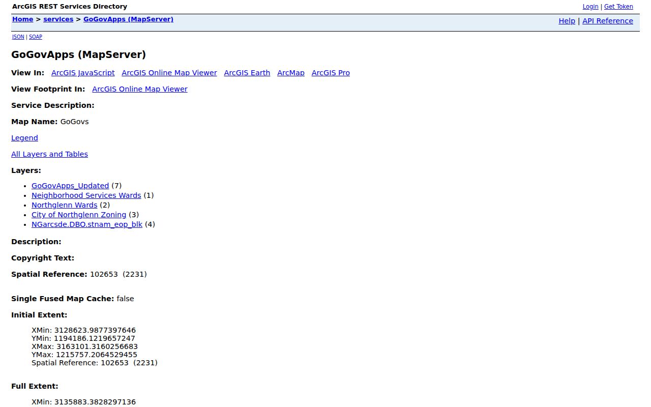
The map is a geography aid. It does not turn an adjacent polygon into a list of Northglenn residents.
For a full block-radius question, the Northglenn neighbors lookup keeps the adjacent-parcel and service-layer work separate from a whole-street directory.
Northglenn Deed Records by Owner
Adams Landmark searches grantor and grantee names, documents, book and page, consideration, record dates, reception or instrument numbers, and legal terms. That makes the assessor-to-recorder bridge essential. Save the owner or party name from the parcel, choose a date range, and read the instrument's legal description and prior-deed reference. Weld's recorder offers grantor, grantee, date, document type, and reception searches and reaches back to January 1, 1865.
A recorded deed is an ownership event. It may involve a seller, buyer, trustee, lender, estate, or organization. Recording does not prove validity, authenticity, or occupancy. Adams copy fees, certification fees, and the recorder's current schedule should be checked before ordering an image. The Weld route is the appropriate alternate for a Section 36 parcel.
Screenshot source: the Adams Landmark Web portal shows the grantor and grantee surface used after the parcel supplies a name or legal-description clue.
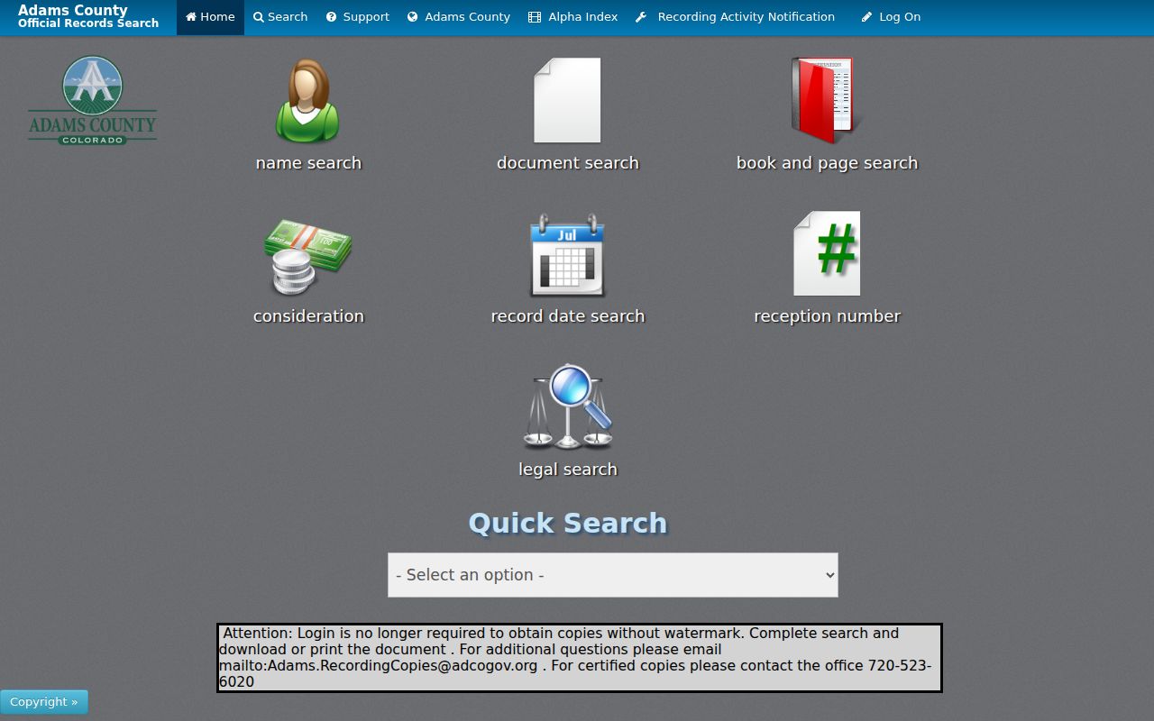
The Adams capture is a workflow reference, not a live Northglenn deed result. A real record needs its party role, date, instrument, and legal description.
Screenshot source: the Weld recorded-document index shows the alternate recorder path for the Northglenn boundary exception.
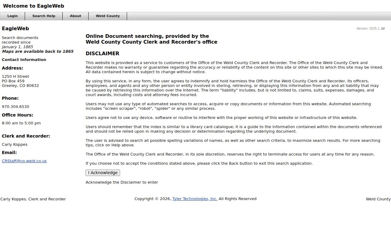
The Weld image documents a search surface, not a live Northglenn deed. Capture the county, party role, date, instrument, and legal description for any real result.
Northglenn Addresses in Historical Directories
Older street evidence may come from a reverse directory, telephone volume, newspaper, obituary, city permit, or local property study. Northglenn's city name did not exist as a municipality before 1969, so older pages may use Adams County, a subdivision, or a broader Denver-metro label. Selected city-hosted studies preserve business and address entries from 1967 to 2020 at 11165 Irma Drive and from 1968 to 2013 at 112th and Washington.
Those studies show why a street directory must name the relationship. A&W Root Beer, Dragon House, Vidal's Mexican Restaurant, and Mercedes Mexican Restaurant are dated uses at 11165 Irma Drive. The 112th and Washington material lists a medical clinic, Schlener Jewelry, IBEW, and Rustic Mountain Roofing alongside permits, rezoning, and acquisition. They are address history and business evidence, not a household list.
When the goal turns from a current street to a historical collection, use the Northglenn city directory collections for DPL, CU, telephone, newspaper, and Archives routes. Keep the scan title, year, page, exact label, and publication context with each clue.
What a Northglenn Street Directory Cannot Show
No public Northglenn street directory lists every household member. Renters, guests, children, unlisted households, private utility customers, and DMV address records are not supplied by the address chain described here. A voter address can be protected or stale. A directory entry can be years old. A business card can name a phone contact without identifying a home.
Colorado's CORA presumption is limited by statutes, court rules, federal law, and public interest exceptions. CJRA, vital-record rules, voter confidentiality, and the Address Confidentiality Program create additional limits. Use the narrowest request route and ask the custodian for a record, date span, parcel, instrument, case, or permit instead of asking an office to create a new resident list.
Lawful use. Northglenn address records are suitable for personal history, property research, civic questions, and other lawful purposes. Do not publish protected fields, assemble a bulk personal list, or use a street directory to stalk, harass, intimidate, or harm anyone.
Precise terms are a trust feature. “Owner of record,” “voter-file address,” “grantor,” “listed business,” and “dated directory entry” say more than the broad word “resident.”